

informed by community aspirations in 2021
These renderings envision Milwaukee’s waterscape 50 years in the future.
What do you imagine?

Based on aerial imagery from Google Earth, the nonprofit Reflo and UW-Milwaukee’s Community Design Solutions created three future vantages for the Milwaukee Community Map.
Use the sliders below to toggle between contemporary Google Earth views and aspirational renderings of positive, plausible 2071 aerial views for Milwaukee's Confluence, Corridor, and Coast.
The renderings are intended to provoke discussion and support education and contemporary collaborative efforts around water.
We invite you to use them to inspire.
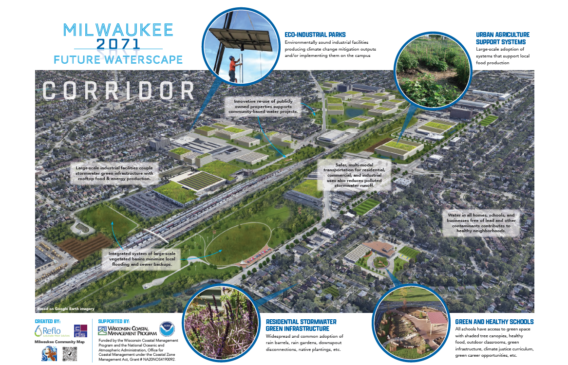


Corridor
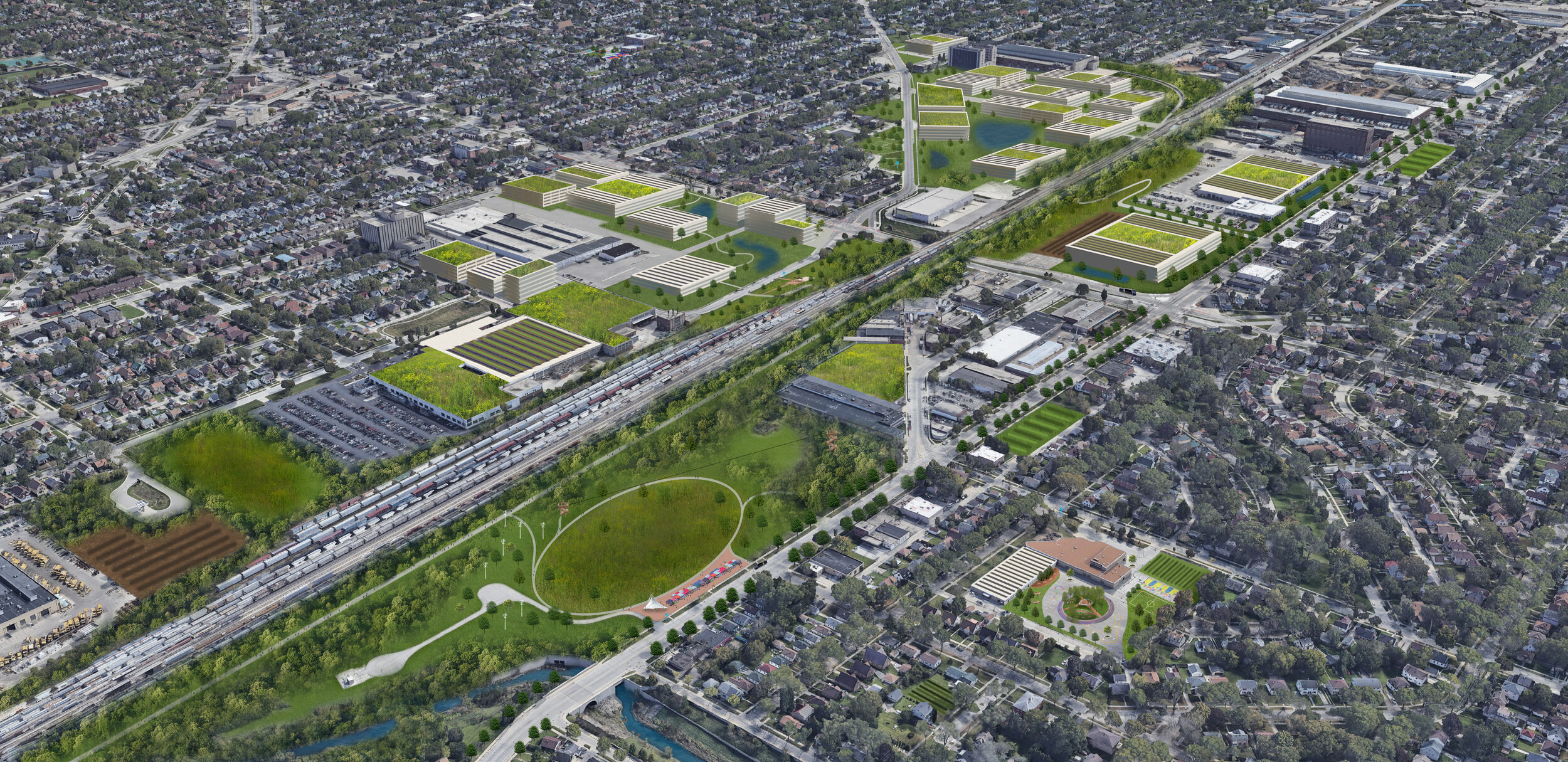
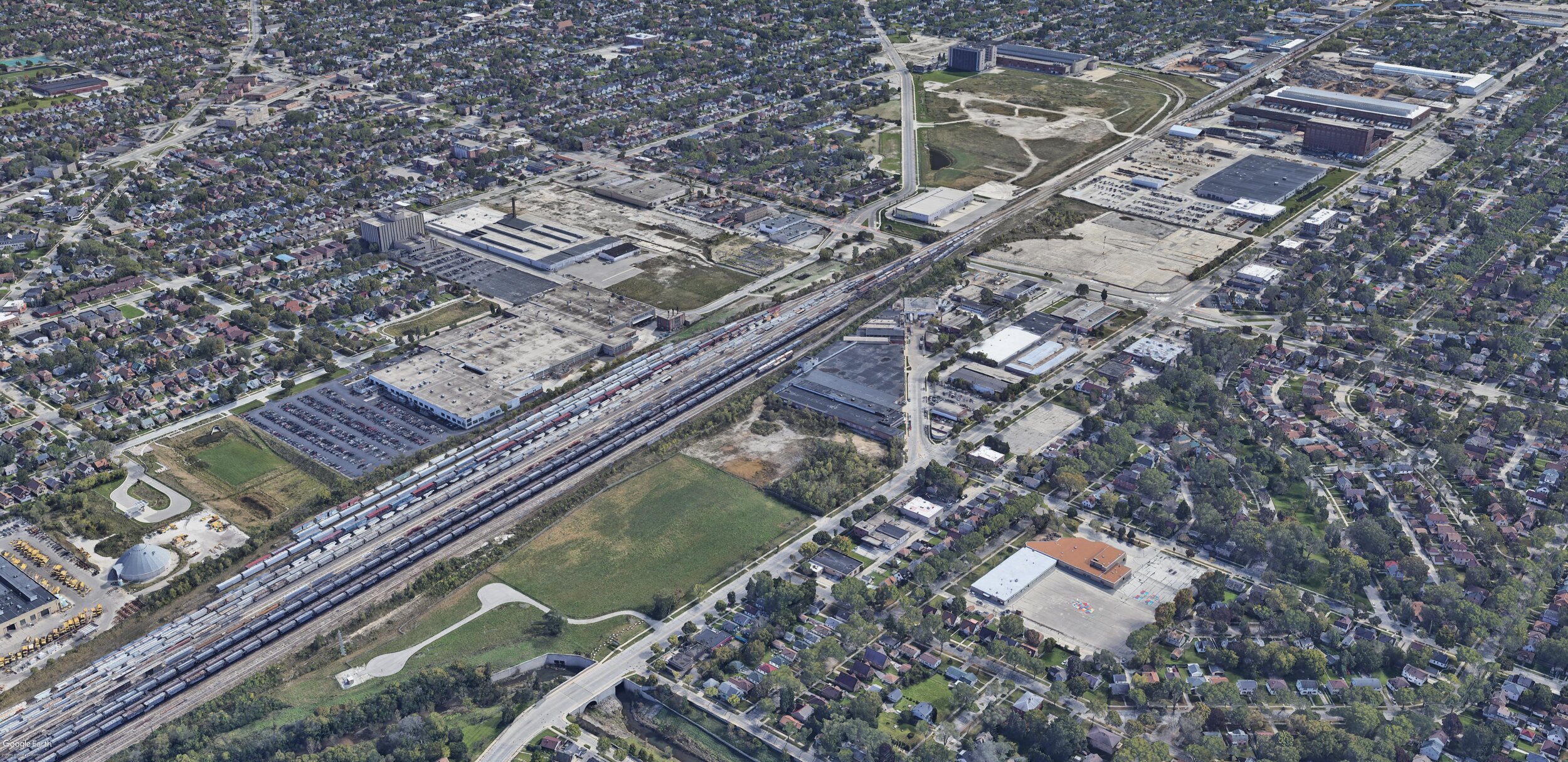
The view is of Milwaukee’s 30th Street Industrial Corridor, looking to the south from the northwest.
The foreground includes the former Bee Bus Line property along 35th Street north of Capitol Drive, which is transition to becoming MMSD’s West Basin. It is envisioned as an impressive green space designed to manage area stormwater and provide other community amenities.
Near the center of the image is Green Tech Station, which in 50 years is envisioned to be canopied by mature trees.
Vacant or underutilized parcels in the footprint of the former A.O. Smith campus are envisioned to host a campus of green/clean tech companies supporting the energy, food, and water sectors.
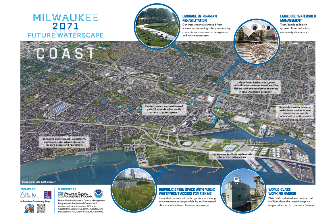
Coast
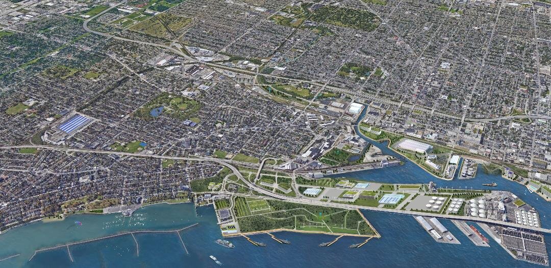
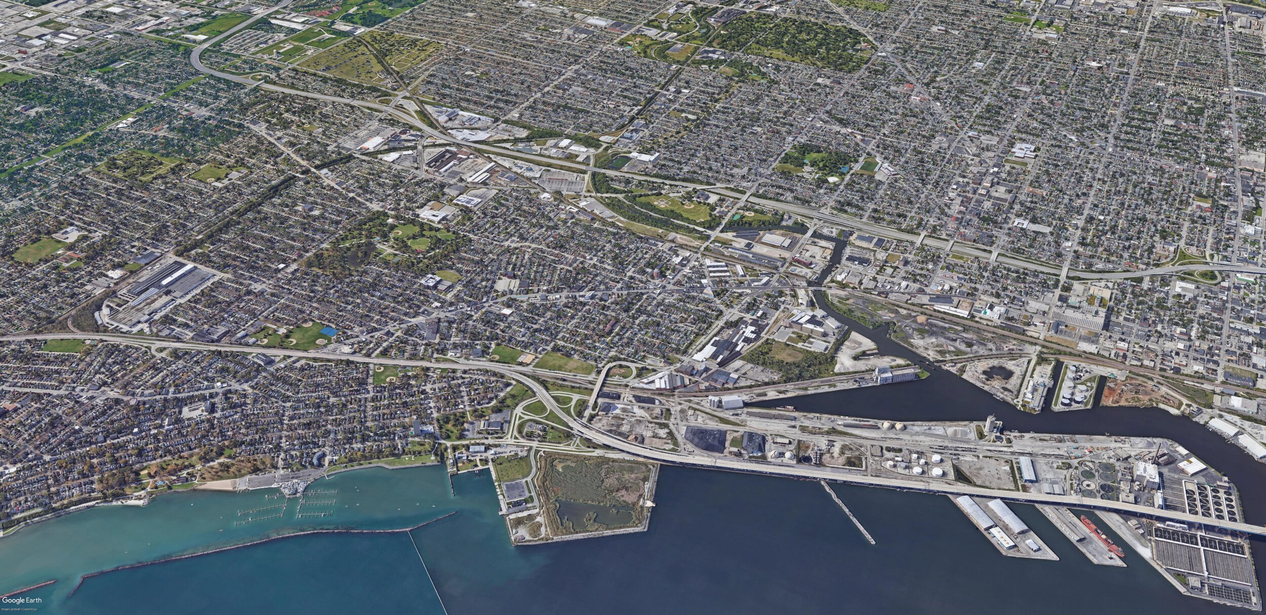
The view looks west from the Lake Michigan coast across the Kinnickinnic River. The Hoan Bridge span is in the far lower right corner, South Shore Park to the lower left.
A major transformation in 50 years is the land formed from the Dredged Materials Management Facility proposed to contain the contaminated sediment dredged from the Milwaukee and Menomonee River bottoms. In the community-inspired vision, this filled lakebed offers public access to a new green space that also supports migrating birds and other wildlife.
The port has evolved in 50 years, no longer processing mountains of road salt that degrade waterways, and an industrial aquaculture cluster emerges to help serve global demand for protein.
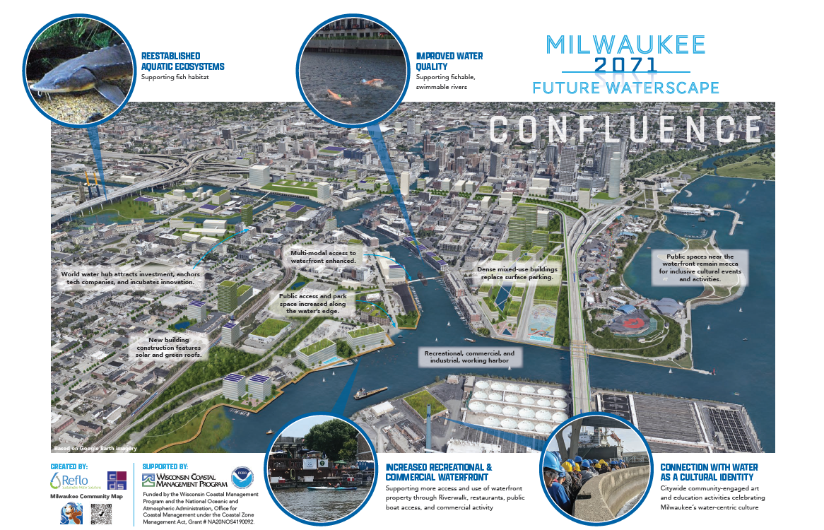
Confluence
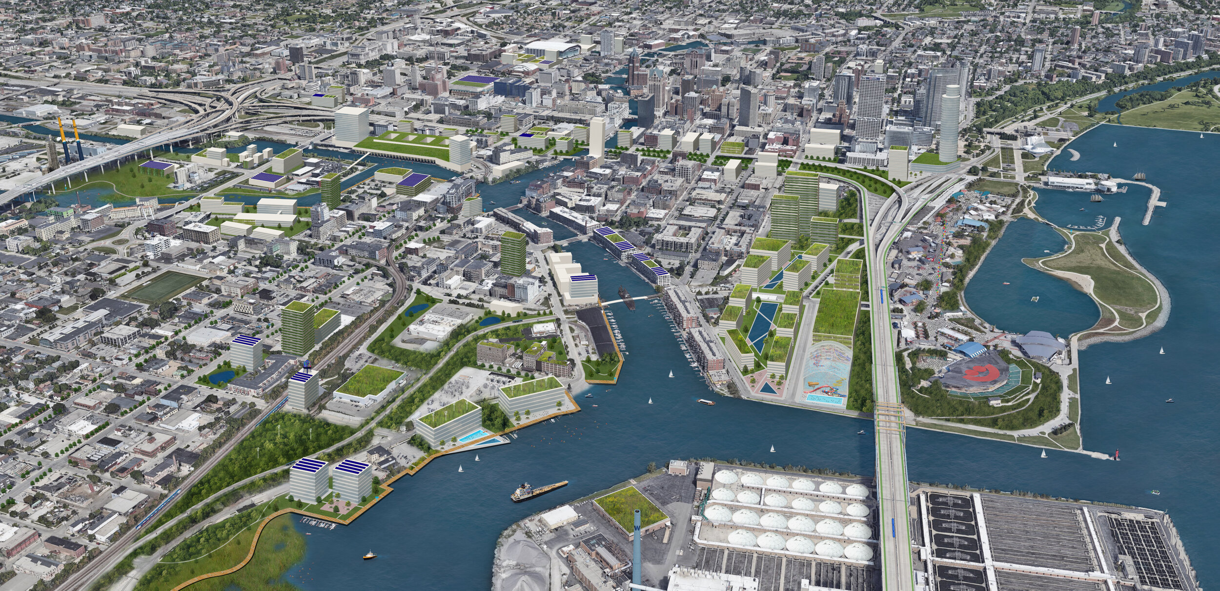
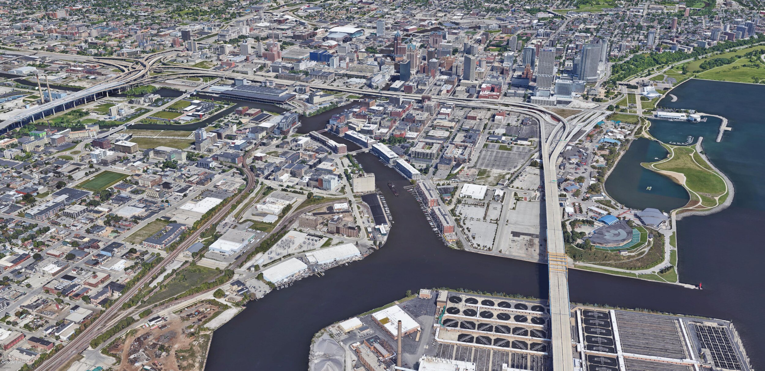
The view looks north across the confluence of the Milwaukee and Menomonee Rivers and their confluence with the Kinnickinnic River as the three rivers flow to Lake Michigan beneath the Hoan Bridge.
Expanded riverwalks connecting the Harbor District, Third Ward, Downtown, and the Menomonee Valley increase recreational access to cleaned waters in the 50-year vision.
In addition to explicitly “green” features that directly manage stormwater, amendments to transportation infrastructure also improve water quality.
By 2071, enhanced fish habitats thrive in the waterways cleaned of legacy contamination.
More to Explore in Google Earth
Milwaukee Community Map in Google Earth Discussion Guide
The visuals above are based on aerial imagery served by Google Earth. Download the Milwaukee Community Map in Google Earth to toggle on and off Story Layers and Basemaps according to custom inquiries; explore Deeper Dives educational exhibits into underwater research, local history, and efforts to improve water quality; and discover what Milwaukee means by Water Centric City.
Support
Thanks to support from Brico Fund and the Wisconsin Coastal Management Program, Milwaukee author and historian John Gurda partnered with us to present animated Water History Tours showing how Milwaukee's waterscape has been transformed by human activity. The tours are shared above as videos. Check out the whole “Deeper Dive” interactive map experience a incorporating the tours plus related interactive content by accessing the Milwaukee Community Map.
The pilot phase of the Milwaukee Community Map was supported by Brico Fund. Phase 2 was also supported by Brico Fund, and from July 2018 through June 2019, in part by the Wisconsin Department of Administration, Wisconsin Coastal Management Program, and the National Oceanic and Atmospheric Administration, Office for Coastal Management under the Coastal Zone Management Act, Grant #NA18NOS4190091.
The City of Milwaukee’s Environmental Collaboration Office supported the creation of the Water Centric City video and interactive map in late 2019.
From July 2020 through June 2021, the Wisconsin Coastal Management Program is supporting the Milwaukee Community Map as we develop Water Stories on climate change, tourism, and public project collaborations. Funded by the Wisconsin Coastal Management Program and the National Oceanic and Atmospheric Administration, Office for Coastal Management under the Coastal Zone Management Act, Grant # NA20NOS4190092.