

A Water Story of Hope
Climate change means more intense precipitation for Milwaukee, Wisconsin, and the Great Lakes.
It also means people are rallying together to create a better future through actions large and small.
This video chronicles the devastation wrought by summer 2010 storms—and shows how far Milwaukee has come in just one decade by co-creating a hopeful water future.
Community Visions for Milwaukee’s Water Future
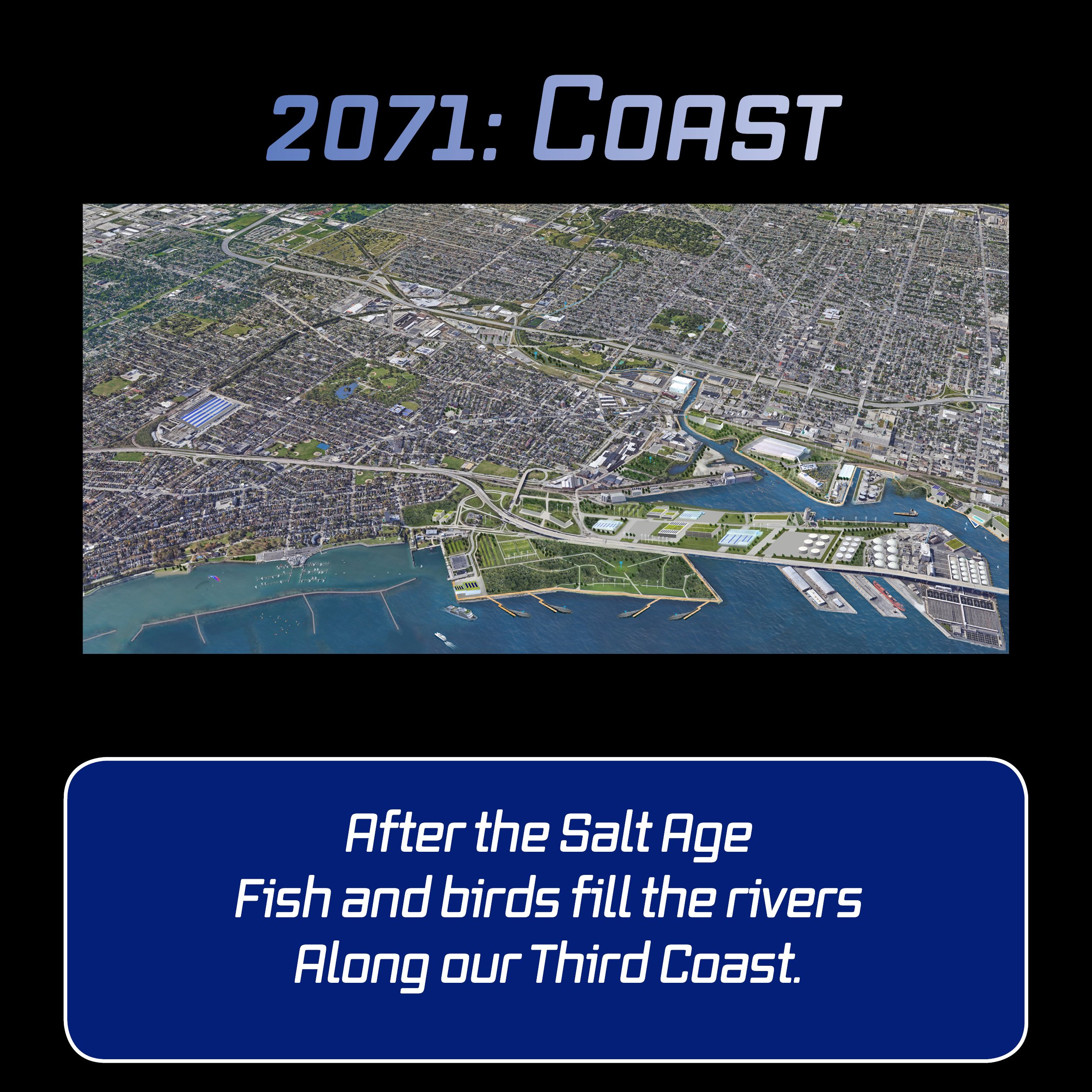
No one can predict the future. But in co-creating our society, it helps if everyone can envision a future worth fighting for—something to aim for, not just react from.
In 2021, Reflo and UW-Milwaukee Community Design Solutions invited input from community leaders to create three map-based visions for what Milwaukee could aspire to be in 2071 if we rally around water and collaborate in the face of climate change.
We hope they inspire conversation and connect you to support ongoing efforts already aligned with these visions for our Coast, our Confluence, and our Corridor.
explore web Maps
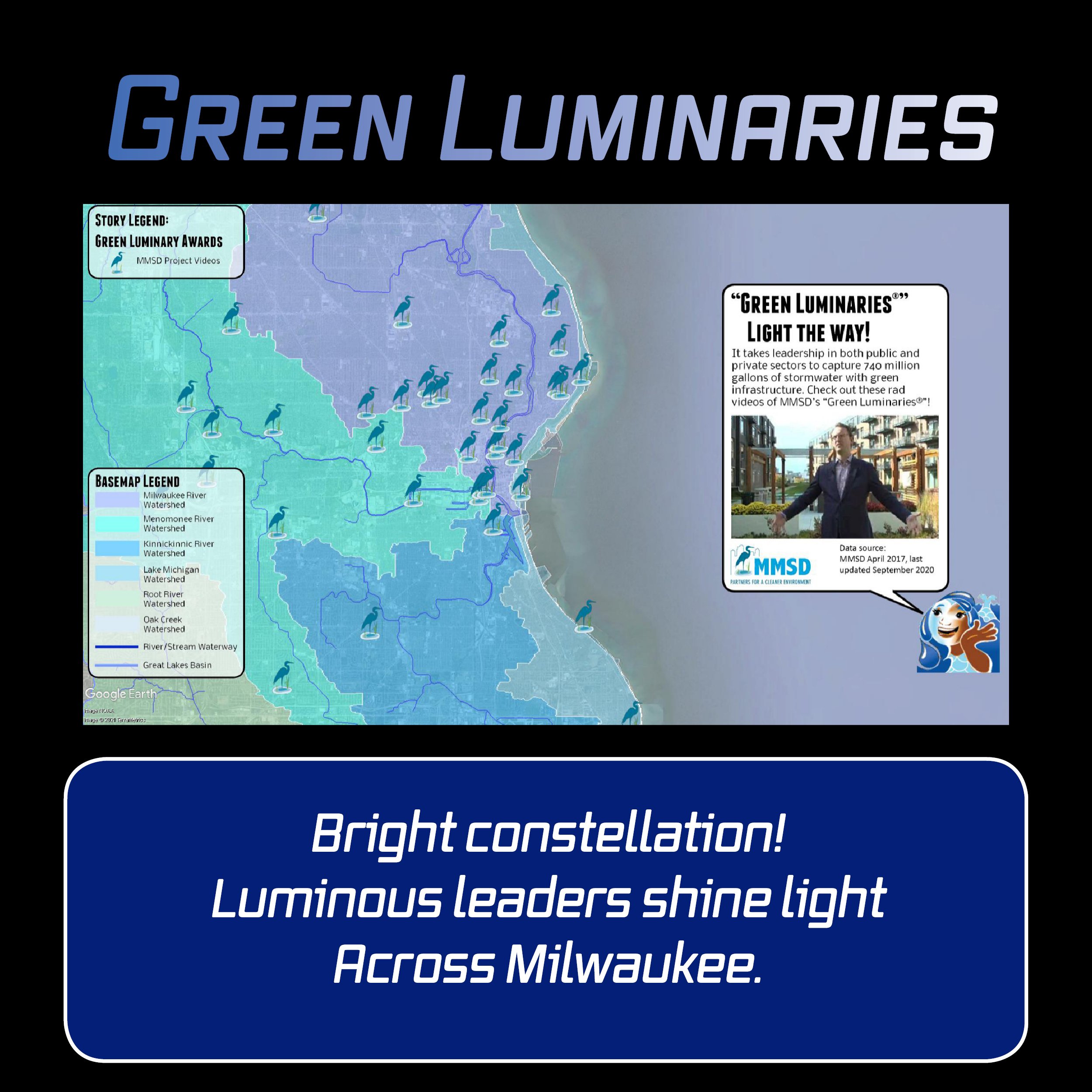
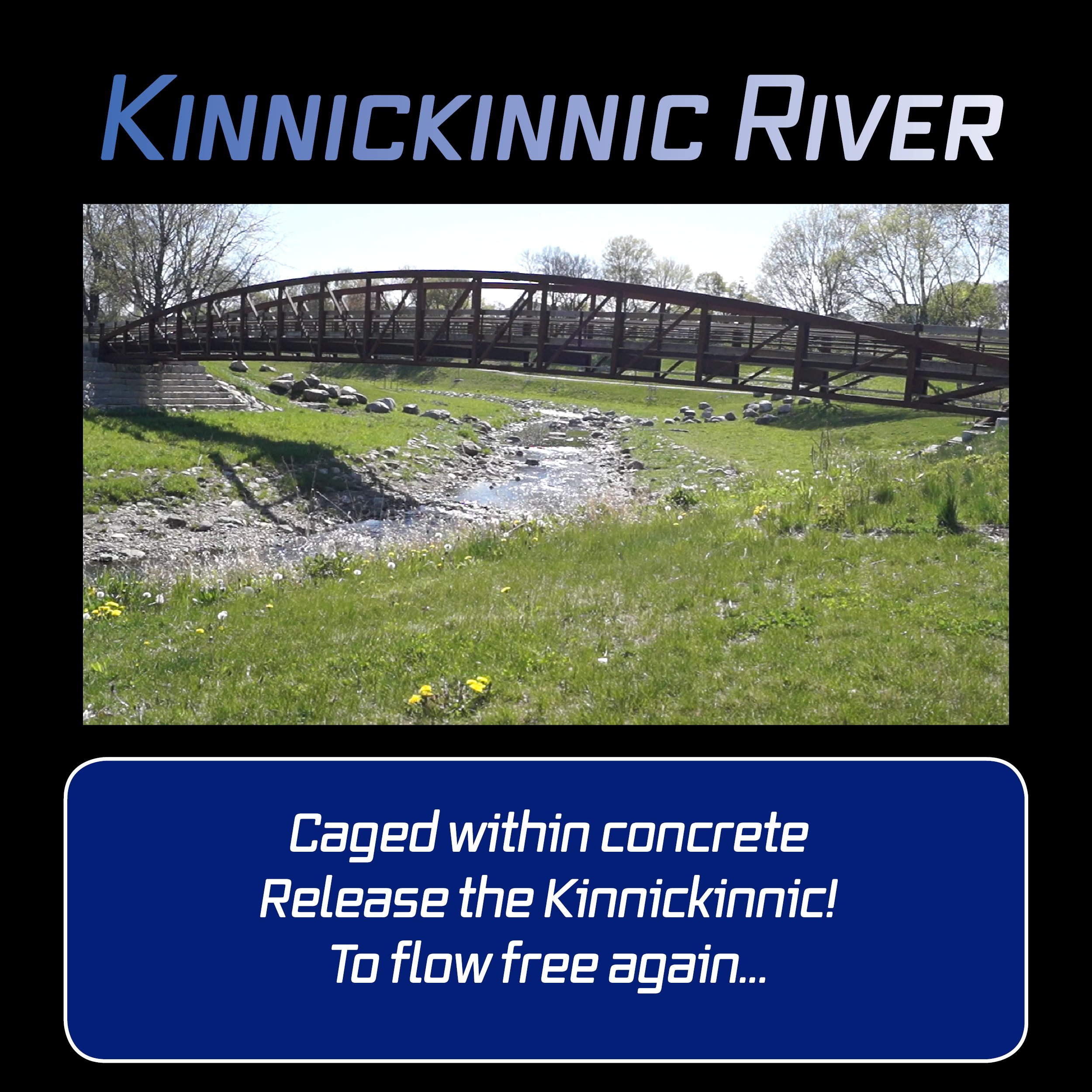
Take a survey of some of the web maps that you can explore to greater depth through the Milwaukee Community Map in Google Earth. The themes unifying these six maps—that will open in your web browser and work on Chromebooks—are climate change, public project collaborations, and water tourism. The Milwaukee community is doing impressive work along all of these fronts and we are privileged to share the tips of these vital icebergs.


Miranda Haikus for You!
Miranda, your Water Storytller, is now ready for Instagram!
Enjoy & Share these Instagrammable short videos, then dive deeper to explore more with the Milwaukee Community Map.
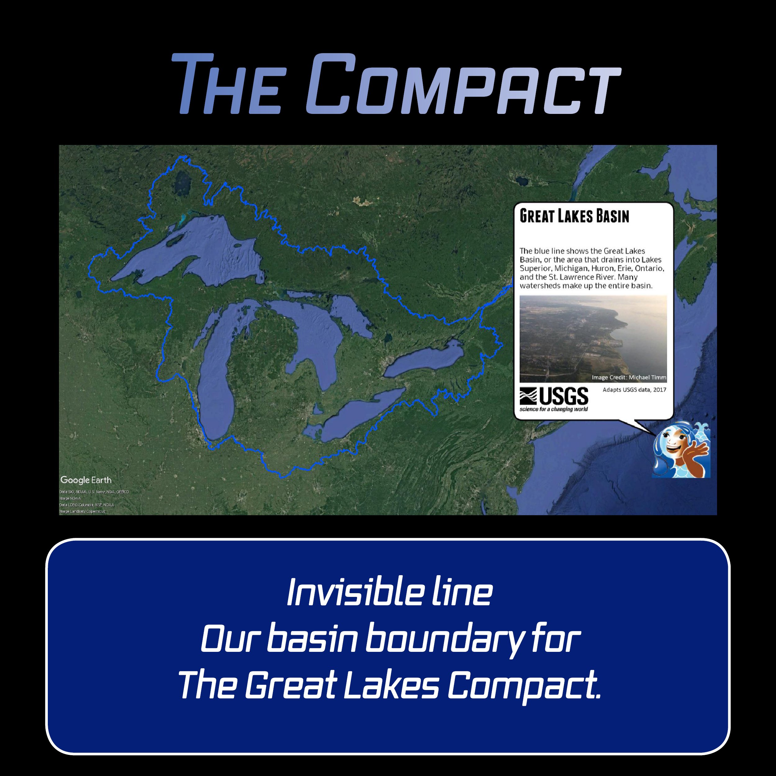
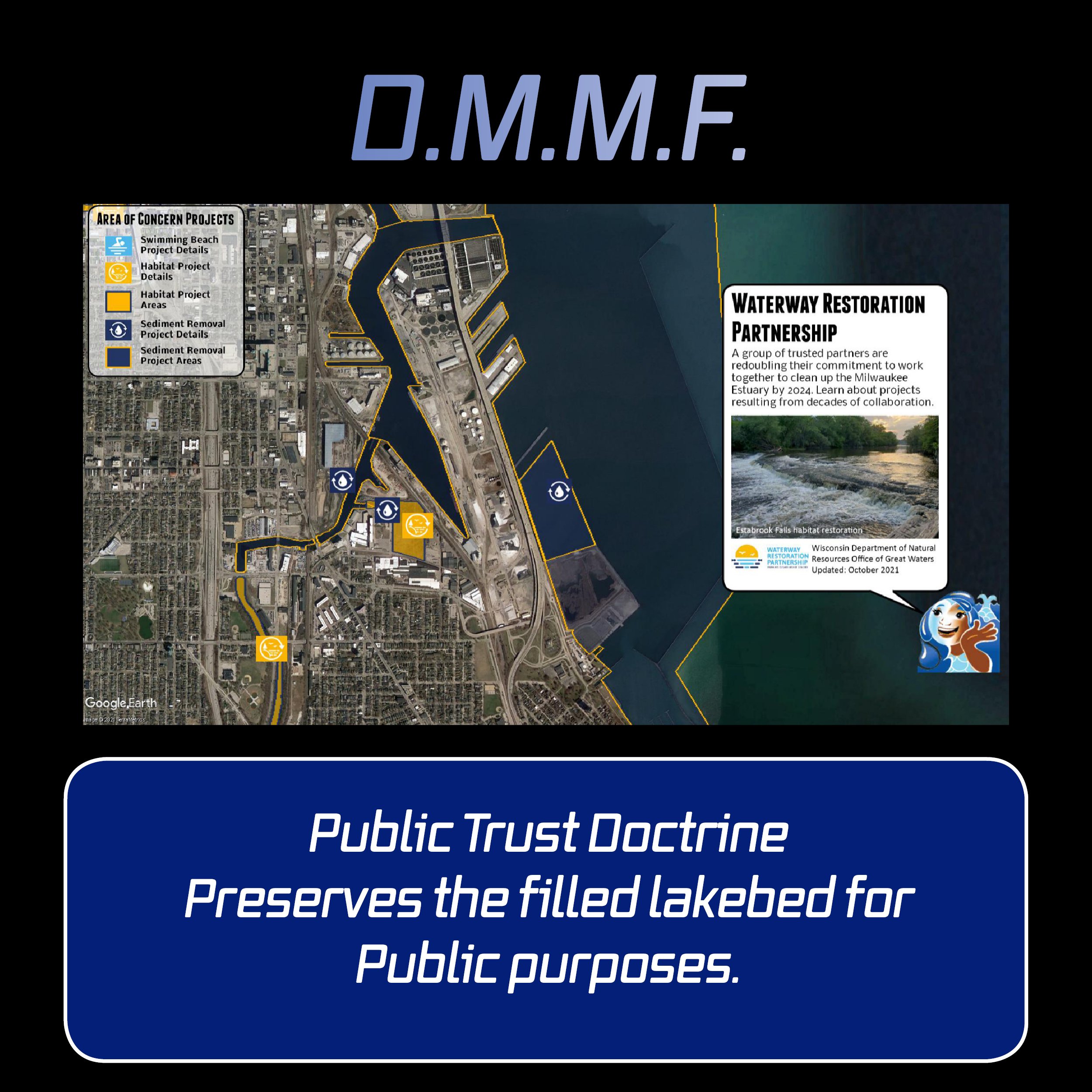
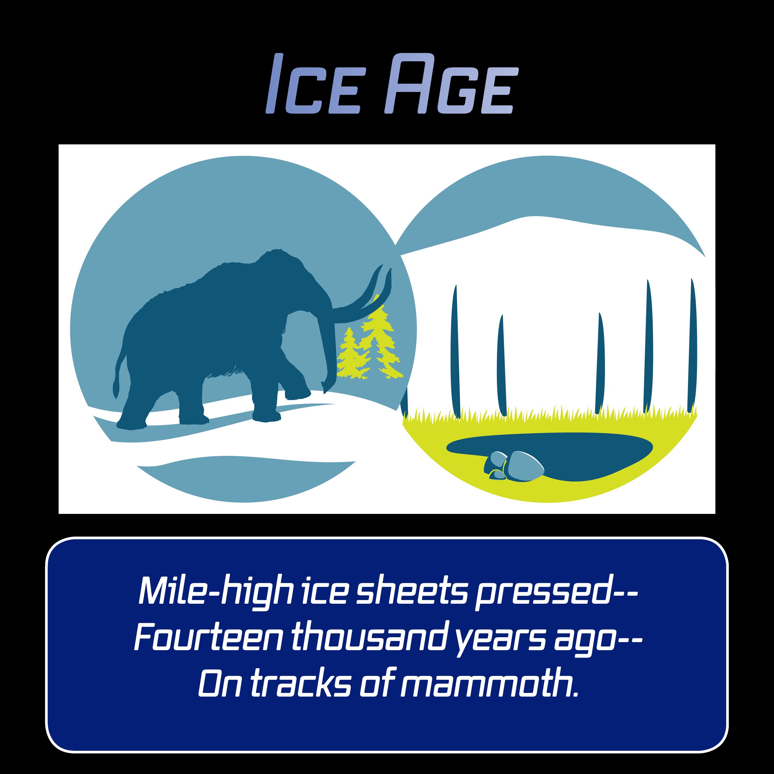
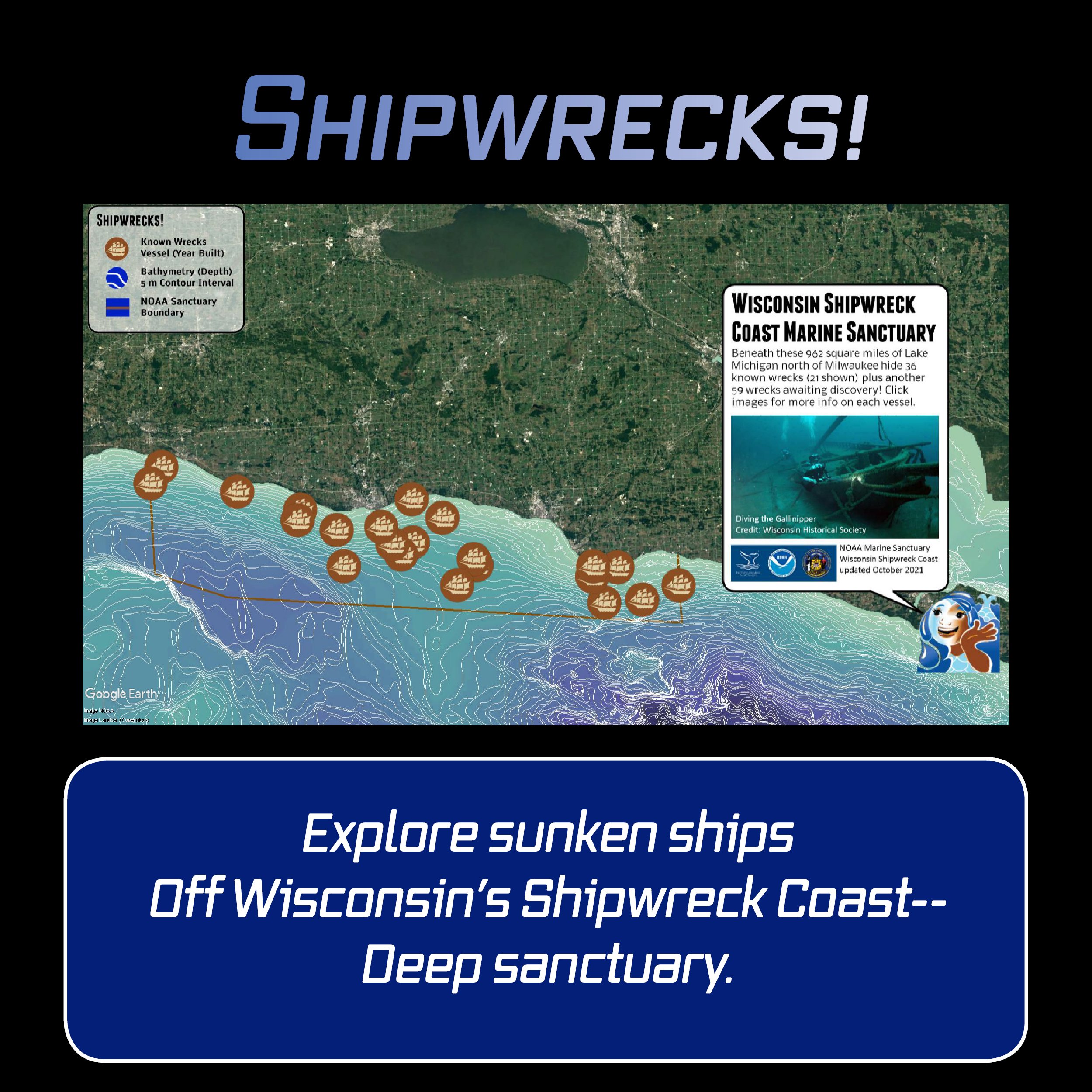
Featuring new Deeper Dives on Climate Change, the Great Lakes Compact, the Waterway Restoration Partnership, the Ice Age, Shipwrecks, and MKE 2071.


More to Explore in Google Earth
Milwaukee Community Map in Google Earth Discussion Guide
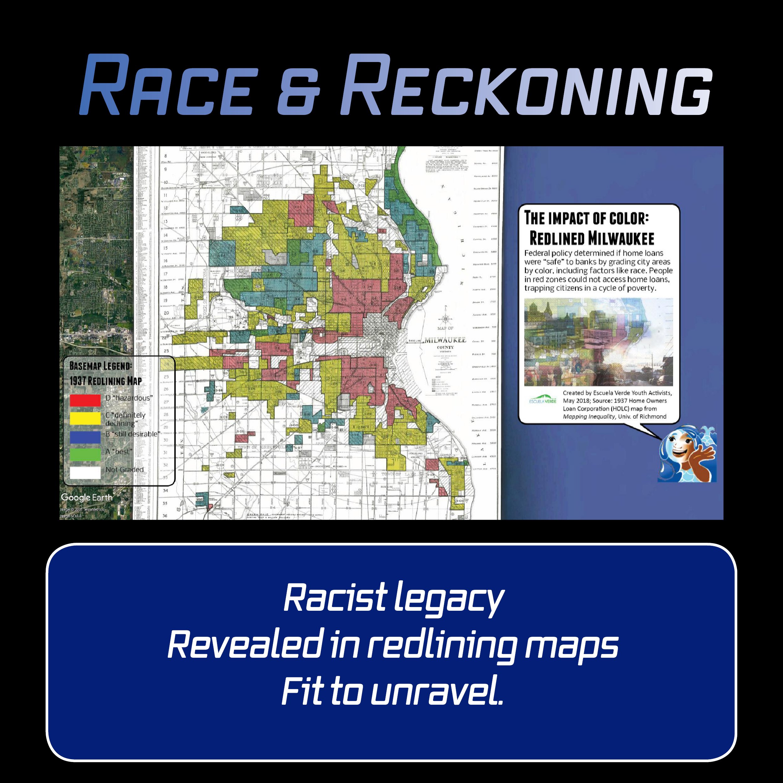
The awesome Web Maps above are just a slice of what the Milwaukee Community Map offers. Download the Map in Google Earth to toggle Story Layers and Basemaps according to custom inquiries; explore Deeper Dives educational exhibits into underwater research, local history, and efforts to improve water quality; and discover what Milwaukee means by Water Centric City.
Now featuring Deeper Dives on Climate Change, MKE 2071, Milwaukee County Parks, Shipwrecks, Ice Age, and the Great Lakes Compact.
Questions or want a presentation for your students?
Contact Michael Timm, Milwaukee Community Map curator or Lisa Neeb, Green & Healthy Schools project manager.
Check out a 20-minute overview and tutorial video webinar intended for grade 6-12 educators on using the Milwaukee Community Map to share water stories with your students and guide them through inquiry and exploration using this fascinating free tool. For the high-quality version of our webinar, please click here. For more educational resources beyond those offered by Reflo, check out the extensive list of 2020 webinars showcased on YouTube by Wisconsin Green & Healthy Schools.
Support
Thanks to support from Brico Fund and the Wisconsin Coastal Management Program, Milwaukee author and historian John Gurda partnered with us to present animated Water History Tours showing how Milwaukee's waterscape has been transformed by human activity. The tours are shared above as videos. Check out the whole “Deeper Dive” interactive map experience a incorporating the tours plus related interactive content by accessing the Milwaukee Community Map.
The pilot phase of the Milwaukee Community Map was supported by Brico Fund. Phase 2 was also supported by Brico Fund, and from July 2018 through June 2019, in part by the Wisconsin Department of Administration, Wisconsin Coastal Management Program, and the National Oceanic and Atmospheric Administration, Office for Coastal Management under the Coastal Zone Management Act, Grant #NA18NOS4190091.
The City of Milwaukee’s Environmental Collaboration Office supported the creation of the Water Centric City video and interactive map in late 2019.
From July 2020 through December 2021, the Wisconsin Coastal Management Program is supporting the Milwaukee Community Map as we develop Water Stories on climate change, tourism, and public project collaborations. Funded by the Wisconsin Coastal Management Program and the National Oceanic and Atmospheric Administration, Office for Coastal Management under the Coastal Zone Management Act, Grant # NA20NOS4190092.