

Web Maps
Take a peek at slices from the Milwaukee Community Map presented right in your web browser. If there’s a map you’d really like to explore in the web, let us know! Anyone may embed these maps in their websites but we ask you include a link back to this page and credit the Milwaukee Community Map.

MMSD: Green Luminary Videos

Sweet Water Trust: Water Quality Mini-Grants

Reflo Community Water Projects

HMI / John Gurda: City of Neighborhoods

Milwaukee-Area Watersheds

Green Schoolyard Redevelopment Projects

UW-Milwaukee SFS: Grads Find Jobs

Plastic-Free MKE: Lake Friendly Businesses

Water Centric City: Selected Green Roofs
Testing the Waters Data Dive
In 2019 and 2020, Reflo supported Riveredge Nature Center’s Testing the Waters program to present 30 years of student-collected water quality data through the Milwaukee Community Map. This is presented publicly as a “Deeper Dive” on the Milwaukee Community Map. To learn more about the student data and associated context, click on the header link above.
Teacher Chromebook Support
In 2020, Reflo supported Learn Deep Milwaukee and several schools involved in the Adopt-a-Storm-Drain program sponsored by Southeastern Wisconsin Watersheds Trust. Especially with the virtual emphasis to learning this school year, Chromebook resources are in high demand. Teachers and students can click the header link above to discover lesson support materials about our sewer system.
Viewing on a Smartphone, Chromebook, or Tablet?
We are working to share more water stories and basemaps from the Milwaukee Community Map for phones, Chromebooks, and tablets. Click above to access the first of these exciting maps via the Chrome web browser or the Google Earth app for smart devices. Really want a particular story or layer from the Milwaukee Community Map accessible this way? Let us know!
Interested in a Workshop or Presentation?
Please feel free to contact Michael Timm, Milwaukee Community Map curator, with questions or follow-up.
Support
Thanks to support from Brico Fund and the Wisconsin Coastal Management Program, Milwaukee author and historian John Gurda partnered with us to present animated Water History Tours showing how Milwaukee's waterscape has been transformed by human activity. The tours are shared above as videos. Check out the whole “Deeper Dive” interactive map experience a incorporating the tours plus related interactive content by accessing the Milwaukee Community Map.
The pilot phase of the Milwaukee Community Map was supported by Brico Fund. Phase 2 was also supported by Brico Fund, and from July 2018 through June 2019, in part by the Wisconsin Department of Administration, Wisconsin Coastal Management Program, and the National Oceanic and Atmospheric Administration, Office for Coastal Management under the Coastal Zone Management Act, Grant #NA18NOS4190091.
The City of Milwaukee’s Environmental Collaboration Office supported the creation of the Water Centric City video and interactive map in late 2019.
From July 2020 through June 2021, the Wisconsin Coastal Management Program is supporting the Milwaukee Community Map as we develop Water Stories on climate change, tourism, and public project collaborations. Funded by the Wisconsin Coastal Management Program and the National Oceanic and Atmospheric Administration, Office for Coastal Management under the Coastal Zone Management Act, Grant # NA20NOS4190092.

Create your own interactive story map with this custom tool.
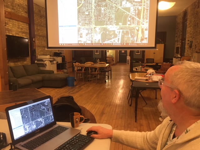
Teacher Don explores the MCM at one of our workshops. K-12 teachers are excited about how the map supports their curriculum, connects students with local water context, and makes links between history, science, social studies, and English Language Arts.

Meet Miranda, Milwaukee Water Storyteller, your Map guide through interactive Stories, Basemaps, and Deeper Dives!
Project Partners


Created by the WATER Connectors


