

Michael Timm
Milwaukee Water Storyteller
mtimm@refloh2o.com
Storytelling + Technology = Engagement
We believe that sharing Milwaukee Water Stories is critical to public awareness that supports transformational water projects meaningful to our communities.
Water flows through our lives, jobs, environment, and society, but too often the relationships seem invisible. Reflo uses storytelling and technology to make these connections visible, tangible, and motivational. We co-create and share engagement resources including interactive maps, games, videos, illustrated stories, feature articles, and the amazing Virtual Water Table.
Email us to arrange to tour the Reflo Gallery, 636 E. Keefe Ave., to explore some of our nifty resources — or scroll down to survey the projects in the Milwaukee Water Stories program.

We are proud of our 2024 series of long-form feature articles, illustrated stories, videos, and maps exploring different facets of Milwaukee’s Water Stories.
Inspired by the approach of National Geographic, this community-supported work was in partnership with the online publication Urban Milwaukee, builds on years of partnerships and engagement resources, and was made possible by generous support from Wisconsin Coastal Management Program.


Since 2017, the nonprofit Reflo has curated the Milwaukee Community Map in Google Earth, a free resource of, by, and for the community focused on exploring the Milwaukee community’s relationship to water.
More than just a map, the Milwaukee Community Map is supported by dozens of stakeholders and provides a suite of interactive maps tooled for student discovery, public engagement, and partner support.


Choose your own MKE Waterscape in our five-player role-playing game inspired by real Milwaukee water history! Play a role and make choices that create our shared history, landscape, and water.
History comes alive as you and four other players make challenging choices that shape an evolving map of our city in the 1800s. How will you balance the demands of a growing city, different perspectives, and clean water? The first level of this screen-based game pairs with statewide curriculum surrounding John Gurda’s Milwaukee: A City Built on Water.

How do you grow a “water choir” into a “water chorus” in large and diverse city with many neighborhoods and perspectives?
Our team supports the massively collaborative WaterMarks initiative—connecting artists, scientists, and community members around place-based water projects. Our contracted role helps tell Milwaukee’s collective Water Story through video and text stories featuring dozens of community voices rallied around neighborhoods or site locations, supporting local artists and partnerships. In 2025 we also premiere the new Field Atlas, a passport-style guide for the public to explore 12 WaterMarks across Milwaukee.


You have to not only see it, but touch it to believe it.
Our Virtual Water Table is an interactive tactile exhibit where you make tangible connections about water — sculpt watersheds, simulate rain, watch virtual water flood and drain.
The Virtual Water Table features an Augmented Reality Sandbox — plus toggles modes with a touchscreen to showcase the Milwaukee Community Map and MKE Waterscape Game.

Discovering hidden water stories is an opportunity for adventure — a way to understand our relationship to water throughout the city with fresh eyes while having fun with friends.
In the 2017 Great Water Race citywide scavenger hunt, we piloted a free place-based mobile app. Geared for school or social outings, the adventure app unlocked hidden stories and experiences hidden in plain sight at six places across Milwaukee — including the Milwaukee River itself. The app is no longer fully supported, but the web companion remains available.

Reflo owns several copies of Mussel Madness, an original board game designed by Michael Timm, and supported its special edition in 2024.
Mussel Madness is a cooperative/competitive game where 2-5 players play as one of the Great Lakes. Can you survive the invasion and make your lake great? If anyone loses, no one can win in this game for ages 10 and up.
Learn more about the game and its real-world inspiration here.


First chapter offered as a coloring book!
GRaphic Novel
An epic tale begins…
Miranda and the Naiads of the Hydrosphere are enjoined in epic battle against the Asphalt Monster and the forces of imperviousness. Who will win is in the hands of ordinary humans making extraordinary choices…
Our Videos
To support programs and partners, Reflo has created various videos sharing facets of Milwaukee’s Water Stories. Check out two of the videos below or explore more videos on this page.
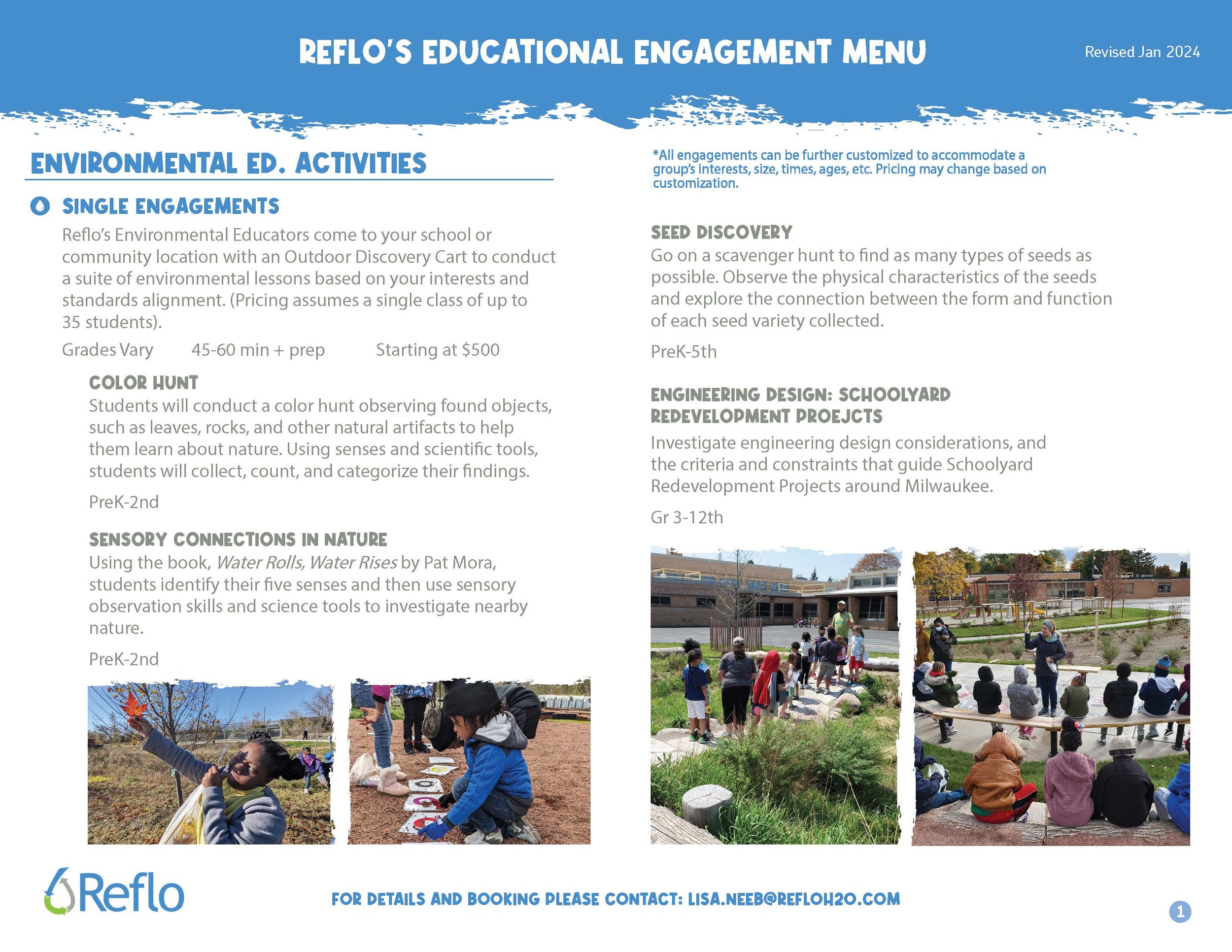
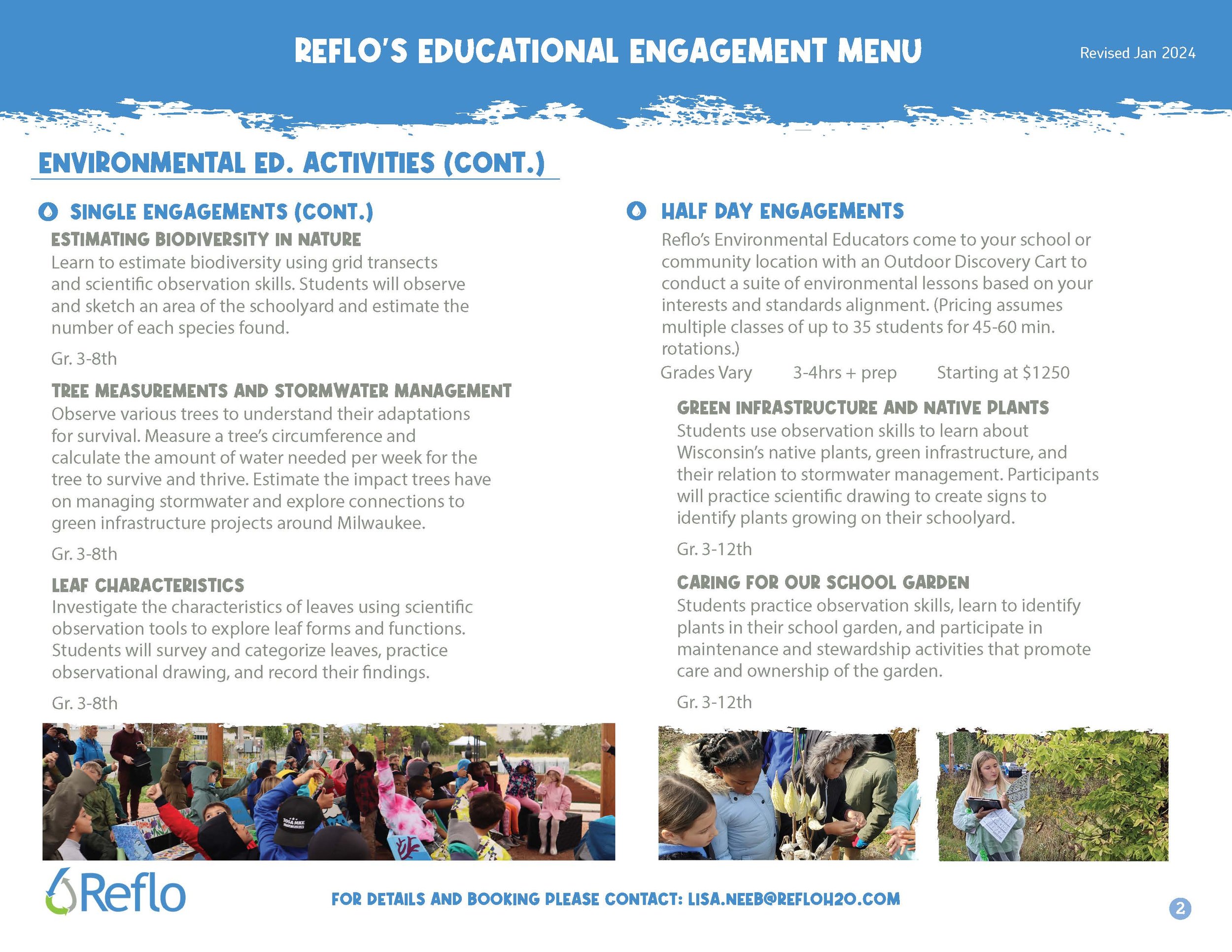
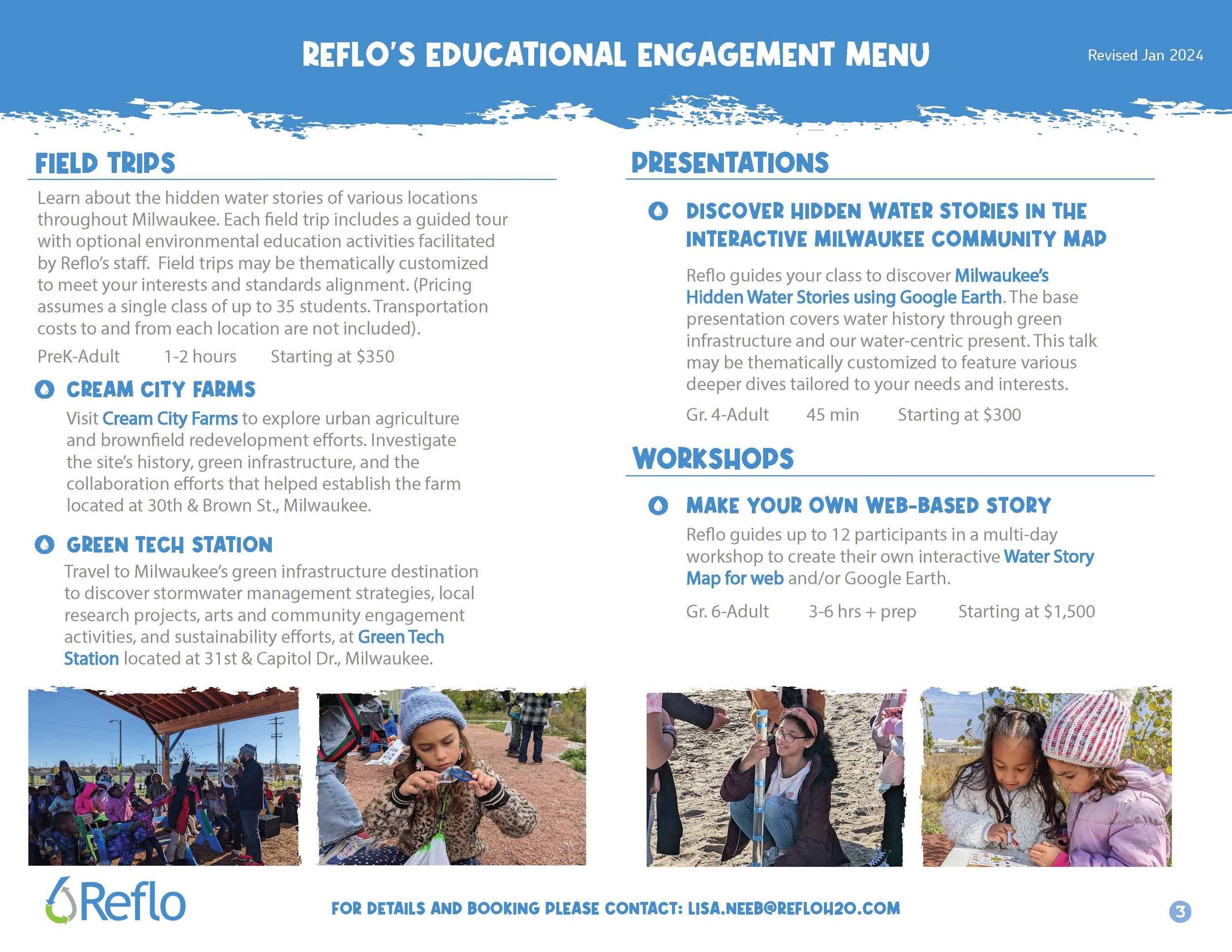
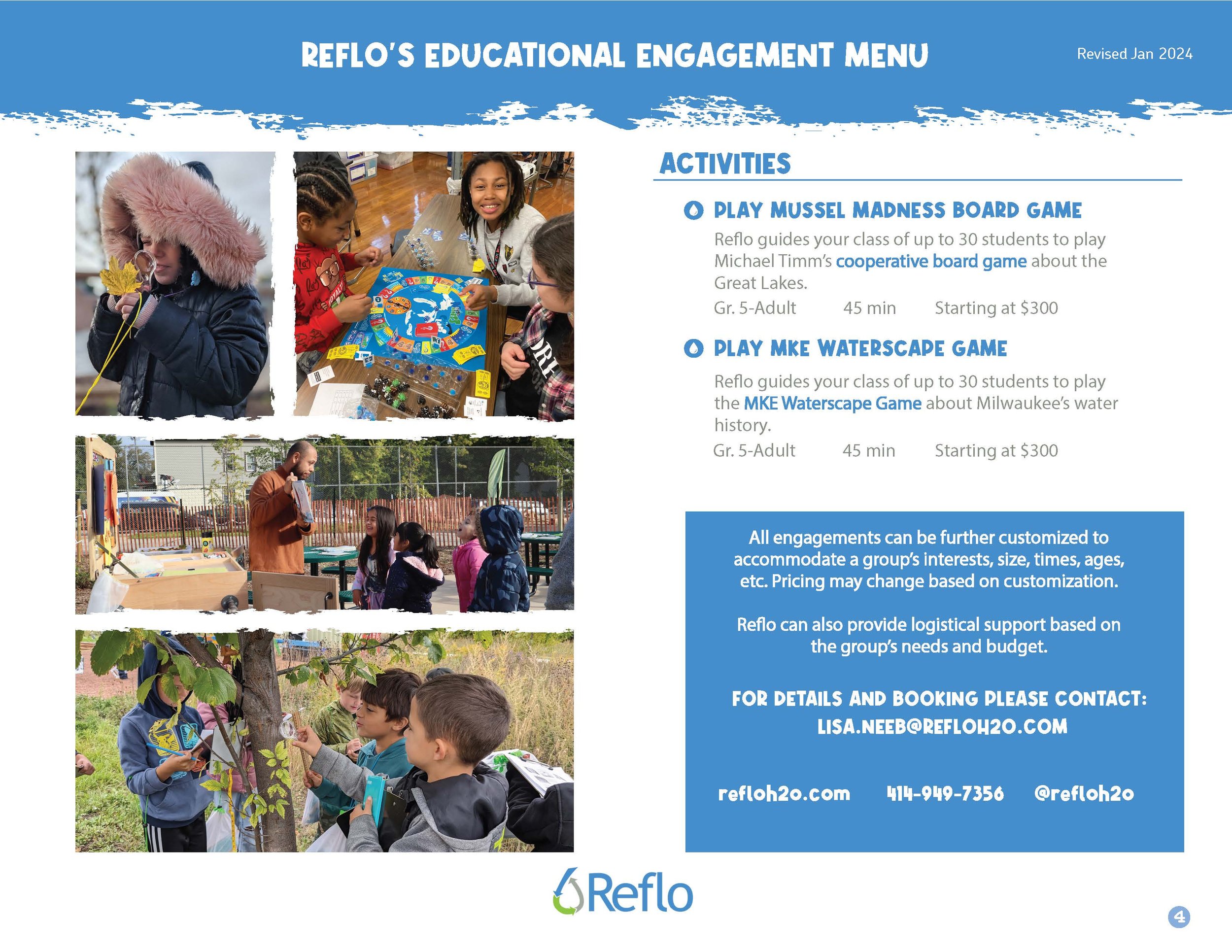
Educational Engagement Menu
Ask us how our tools can help educate and engage your audiences. Our Educational Engagement Menu includes fee-based activities our team can support to suit the needs of your audience.
Newsletter
Subscribe to our monthly Milwaukee Water Stories e-newsletter for program and partner updates.
Testimonials
“We used the Milwaukee Community Map to help us better understand the story of communities surrounding Milwaukee. We looked for general trends in stormwater needs using layers such as basement backups, demographics, sewersheds, and watersheds to help prioritize placing green infrastructure in areas where it can do the most impact for good. Layering the various map features allowed us to have a more holistic view and complete story for the municipalities we were working with.”
“Thank you Michael Timm, Milwaukee Water Storyteller with Reflo, for teaching and enlightening residents, guests, and staff about hidden water stories using an interactive map. Everyone was absolutely captivated and engaged in his fascinating presentation about one of our most precious resources: water.”
“Something our team has really valued about your work, and the work of the Milwaukee Community Map, is how much it emphasizes the importance of thinking about what maps can say and what stories we might tell with them. As farther-away collaborators who care deeply about what’s happening on the ground in Milwaukee, it’s incredibly helpful to have resources and teammates who can help us find our way. Please know how much we appreciate your partnership!”
“Thank you again for the truly fascinating presentation. Quite frankly it reminded me of a museum. I felt that we only touched the tip of the iceberg of information available in this program and could spend a week exploring! There really is some aspect of interest for everyone showing and explaining the history, present, and future. ”
“The maps are fantastic and very helpful. My students will certainly get a kick out of this when we share and discuss this. There is so much information here that I can share with my students that will help them to better understand how our community has evolved over time. Thank you for creating this important resource. I think we will take our knowledge on a walking tour of our neighborhood.”
“Thank you so much for putting all this together! This was clearly a major undertaking, and the end result is excellent!”
“One of our aims with the projects developed within the Learn Deep Fellows programs is for students to have the opportunity to see their work as a contribution to efforts in the broader community. With the water focus of this year’s projects, Reflo’s Milwaukee Community Map and Water Stories projects serve as more than just useful resources for students and teachers involved in the work. They provide a place where the work of students involved in the Fellows projects can be shared with the community and enrich the value for others that use the tools.”
“Appreciate all your help on this project. I think the web maps take the Water Passport to the next level!! The Milwaukee Community Map has been a great addition to the program!”
“The Milwaukee Community Map is a great one-stop shop with a lot of information about Milwaukee’s waters.”
“Thank you for everything that Reflo did to make our Family Day: Great Lakes Cycle program a roaring success. From the start, you were a generous and gracious collaborative partner who worked with us in an organized, thoughtful, and professional way. Through those efforts, you brought a dimension to this program that we simply could not have begun to replicate. I’ve worked on many collaborative programs throughout my career, and this was one of the most rewarding. And that Virtual Water Table of yours is downright amazing. ”
“We as a collective group felt that the greatest benefits of the [Virtual Water Table] were that the students were able to have a hands-on experience, learned how different land structures affected water flow and drainage, that having this experience led to both teachers and students having additional questions about water (for example erosion and its effect on water quality, how water actually filters in the ground, how this project could be used to link our playground project in the fall, and this project showed students how technology can help us learn in more ways than just playing a video game.)”
“Thank you so very much for speaking to the students about our local watershed. It is so valuable and inspiring to have you working to protect something so important to Milwaukee, to Wisconsin, and to the world. ... Thanks again for the amazing presentation. The girls raved about the Milwaukee Community Map and understanding things they have seen but didn’t understand in the city (like the pipes draining water into common areas). Some girls were learning about GIS and thought it was cool to see it in use. WELL DONE!”
“I am a member of Friends of Lincoln Park and our neighborhood coalition “Save Our Pool.” We want to thank Deidre Peroff at UW Sea Grant, Milwaukee Water Commons, and Reflo for creating the maps that helped us save the Schulz Aquatic Center in Lincoln Park. We were able to present the map to our County officials as evidence of a racial disparity that exists and was at risk of being expanded. We had our neighborhood kids make posters about what losing “Milwaukee Swims” would mean to the water safety of our neighborhood residents, especially children. I mentioned the maps in testifying before a Wisconsin State Assembly hearing on how “Save Our Pool” taught our children about democracy and the health of their community.”